With Agents of Change, IABR provides researchers, architects, and thinkers with the opportunity to explore a topic in greater depth. These individuals are selected to work on spatial themes that often fall outside the usual design domains. Developing new perspectives and alternative forms of knowledge sparks the imagination and potentially stimulates public debate. The results are published as videos, conversations, essays, and lectures within the IABR network and on the website.
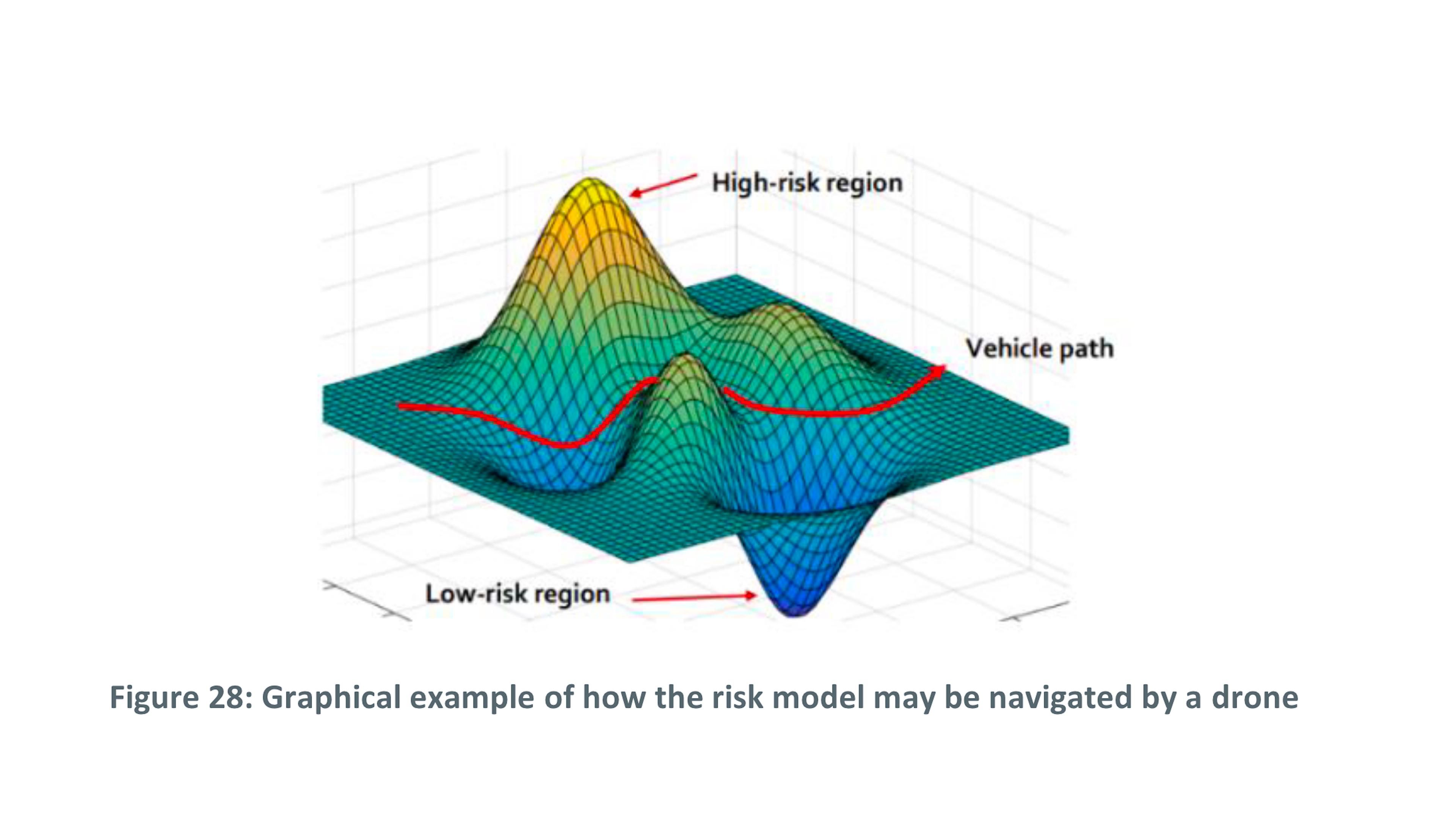
After Airspace, Data Hazard contributes to a larger study about the social and spatial implications from introducing passenger and freight drones into the European Union. Within the EU drones are described as “new aviation.” This title has its basis in European Commission policy (EC, 2014) and importantly reveals the constellation of expertise that has jurisdiction over designing urban space for drones. Aviation’s traditional scope of concern is national because countries’ have sovereign control over their airspace, and simultaneously planetary, the outcome of more than eighty years of transnational institution building. However, drones act at the scale of front- or back-yards, rooftops, warehouses, hospitals; they traverse streets, districts, infrastructural corridors and cities as well as extended urban regions. From the perspective of architecture and urbanism this presents a set of questions. How does aviation expertise view and understand the city and extended urban regions and what conceptual frameworks, tools, or formal techniques does it apply in the design of urban space for drones? Because this presents a large field of inquiry, After Airspace, Data Hazard focuses on one aspect, the use of digital protocols for designing urban airspace.